IceEco focuses on ecosystems within and around coastal Greenland. Our research is built with a collaborative spirit, and with NASA support we work with tour companies, their guests, remote sensing and marine ecology scientists, and with the local Greenland communities through outreach and participation.
Where we work


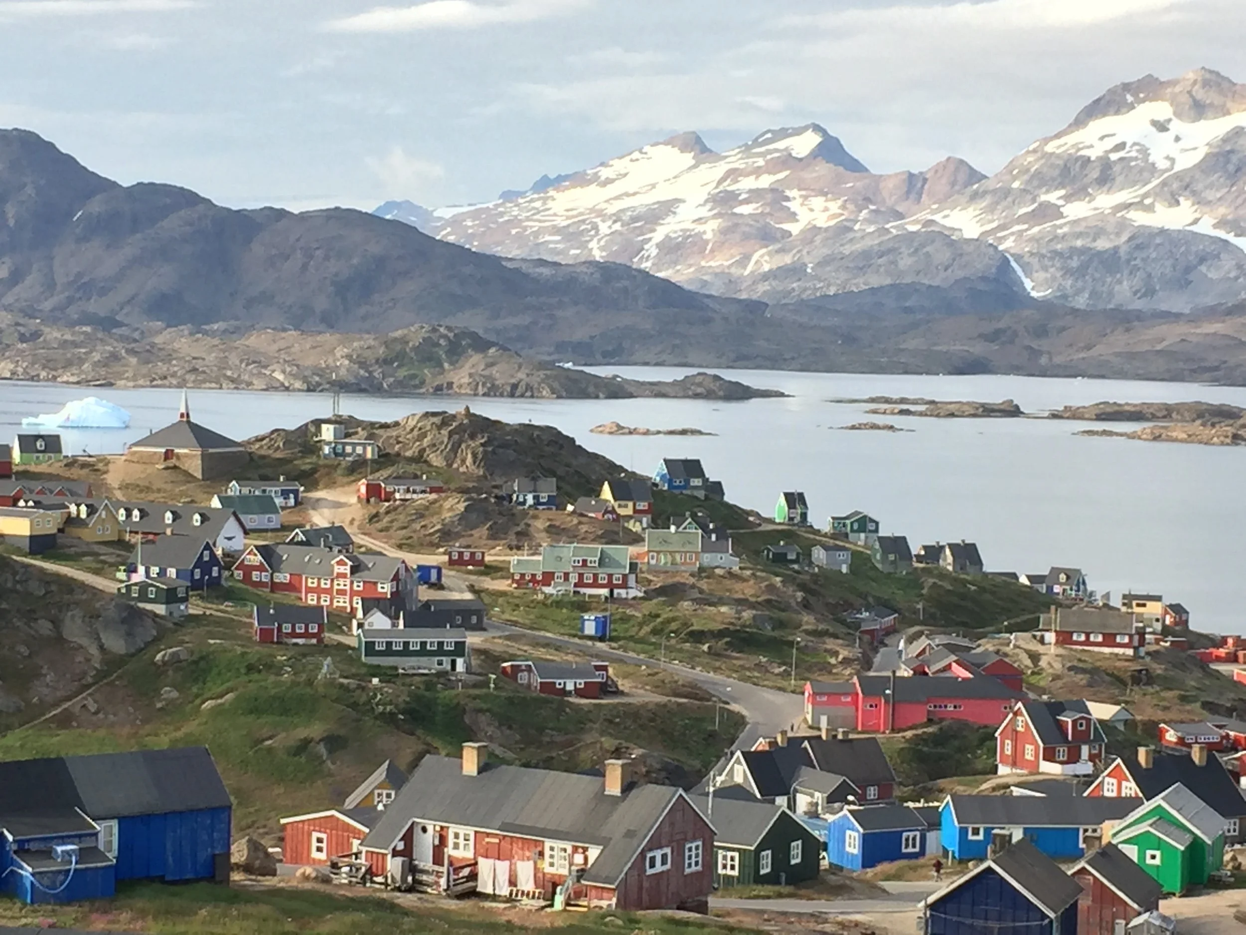
Our work is conducted along the coasts of Greenland (Kalaallit Nunaat) by the gracious allowance of the Greenlandic people. Kalaallit Nunaat is a 2 million square km island in the Arctic and has been a self-governing country within the Danish Realm since 1979. We acknowledge that we are guests on these lands and surrounding waters, and honor the independence, rich culture, and stewardship of this place by its people, including the Inughuit, Tunumiit, and Kalaallit.

IceEco Project
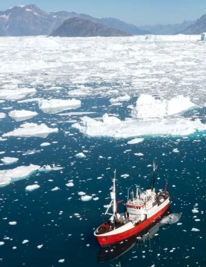
We combine satellite-derived data with physical and biological data collected by guests on tour ships to investigate the impacts of melting glaciers and icebergs on Coastal Greenland Ecosystems.
We are using these data to validate a new remote sensing model on meltwater, investigate how iceberg abundance and meltwater concentration affects the base of the food web (phytoplankton) and marine predators (seabirds). The main goal of our project is to better understand overall ecosystem effects from melting ice sheets.
Research Goals
What is the variability in space and time of icebergs and meltwater at the ice-ocean boundary?
What are the impact of icebergs and meltwater on phytoplankton and seabird abundance and community composition?
What are the broader impacts of the dynamics between icebergs, meltwater, and the food web on these coastal ecosystems?

Data Collection
The use of tour vessels allows us to sample from late-spring through summer, and remote-sensing observations are used to expand the spatial and temporal scales of data collection in this remote region.
Citizen Science

Tour ships and their guests visiting coastal Greenland provide valuable access to this remote region. We work with tour companies and provide training and equipment to expedition guides which enables them to assist guests, our citizen scientists, with collecting the scientific data.
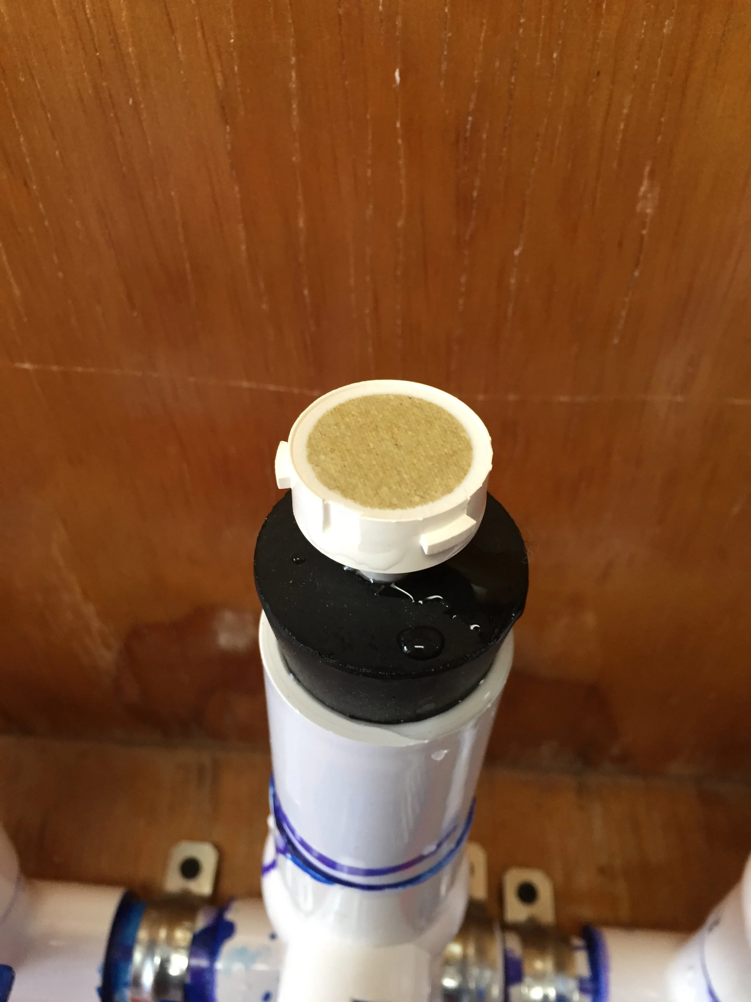
Guests collect physical and biological data from small boats under the guidance of a field guide, including water samples for measuring phytoplankton and iceberg meltwater, observations of seabird abundance, community composition, and behavior, and measurements on the density of surrounding icebergs. These data are then sent to researchers at the Scripps Institution of Oceanography and their collaborators for analysis.
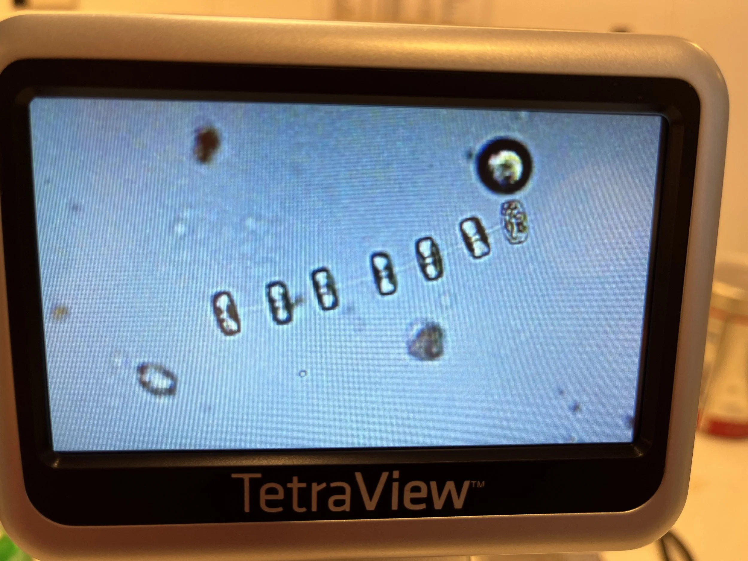
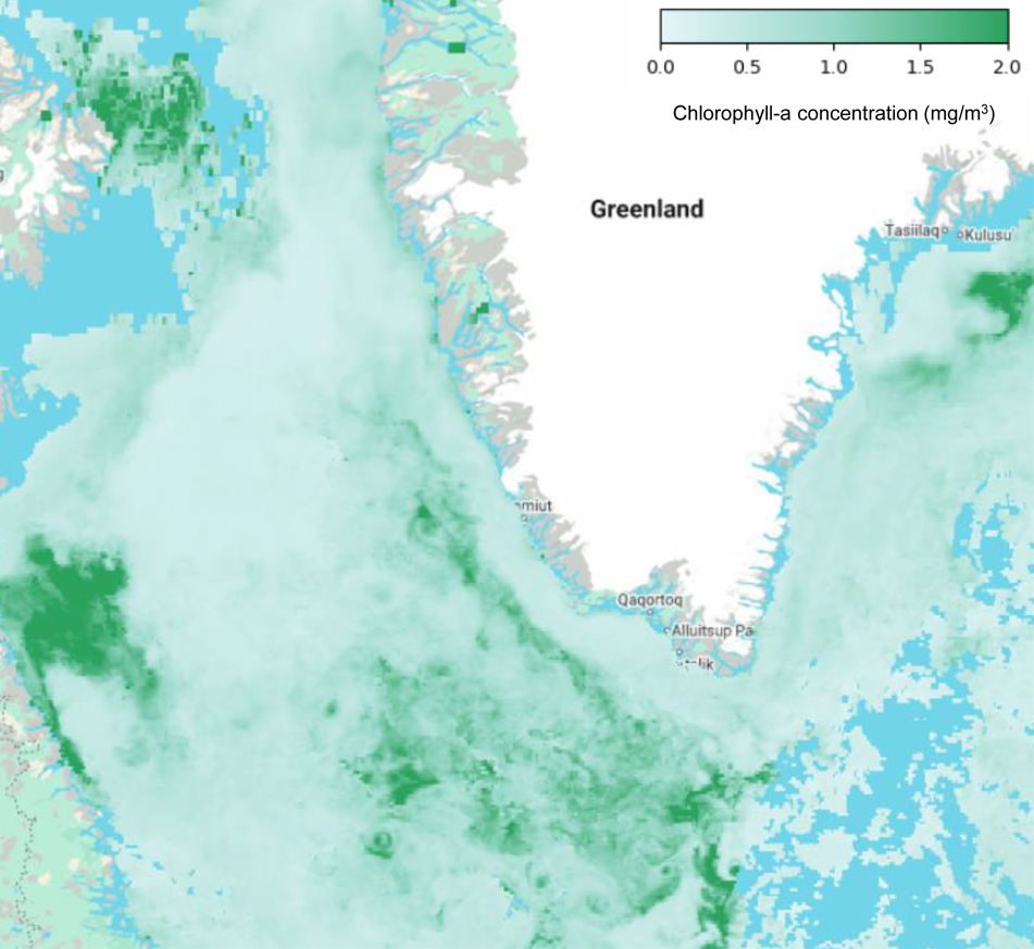
We also use satellite-derived estimates of chlorophyll-a concentration to compare to our ship-board measurements and expand the spatial extent of our research. Chlorophyll-a is a photosynthetic pigment present in phytoplankton, and variations in its concentration can be used to understand patterns of plankton abundance. This work results in a broader understanding of phytoplankton abundance trends among seasons and with different environmental conditions.
We also use field-collected data to validate a new remote sensing model on meltwater in order to understand region-wide spatial and temporal patterns of meltwater and investigate relationships with the marine food web.
Remote Sensing
Community & Outreach
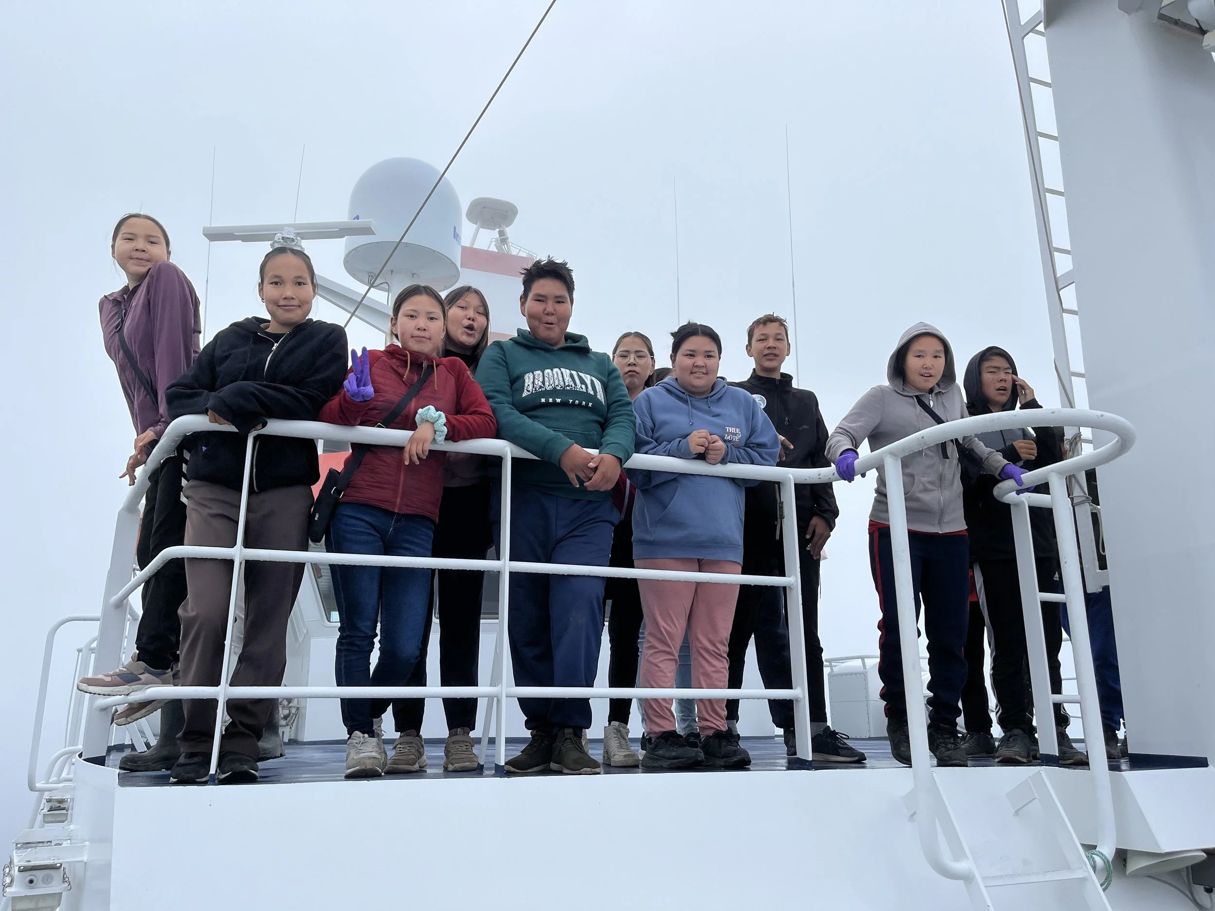
While our researchers are in Greenland to train expedition leaders and/or participate in cruises, they conduct outreach with the local community.
During an expedition with collaborators in 2024, we participated in many different activities to engage and get feedback from the community. We invited a local teacher to join our science party for the duration of the cruise, and hosted several other teachers onboard to share the work we were doing. We also worked with an outreach program, Greenland Rising Project, and collaborated to organize several activities with local school children (grades 8-10), including hosting them onboard and visiting their school to share our research.