Iceberg Ecosystems
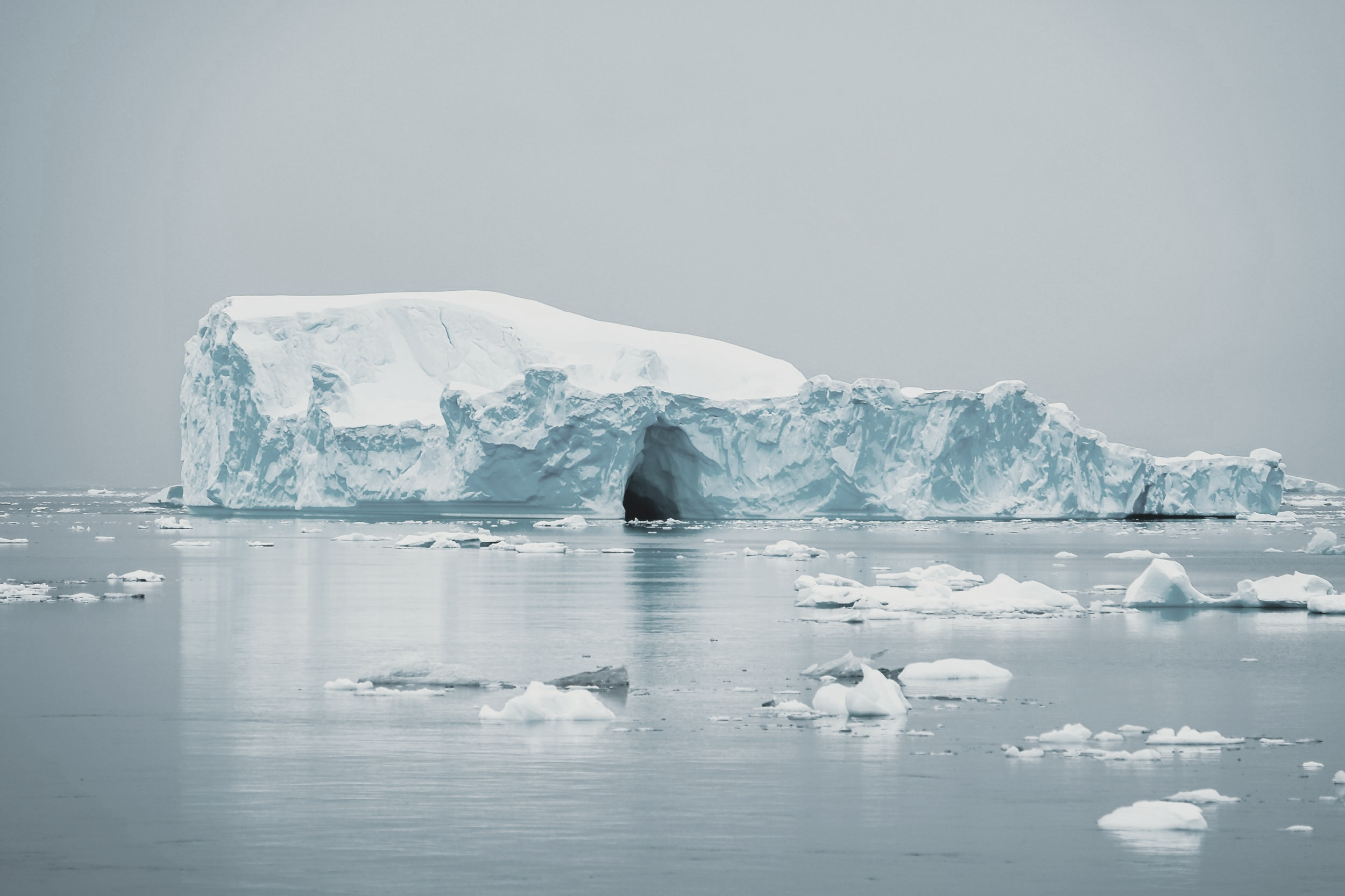
Photo by Dr. Jack PanUsing remote sensing and citizen science to understand the impacts of icebergs and meltwater on the Arctic marine food web

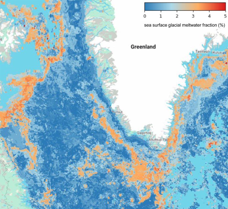
Coastal Greenland is experiencing measurable impacts from climate change. To understand how these habitats are affected by melting ice sheets and the presence of thousands of melting icebergs, we use a multifaceted approach.
We combine remote sensing (satellite-derived) observations of ocean properties with physical and biological data collected by citizen scientists onboard tour vessels to validate and refine a new remote sensing algorithm to detect iceberg meltwater, characterize phytoplankton and seabird abundance and biodiversity, and to study the potential impacts of melting ice sheets on the coastal marine ecosystem.